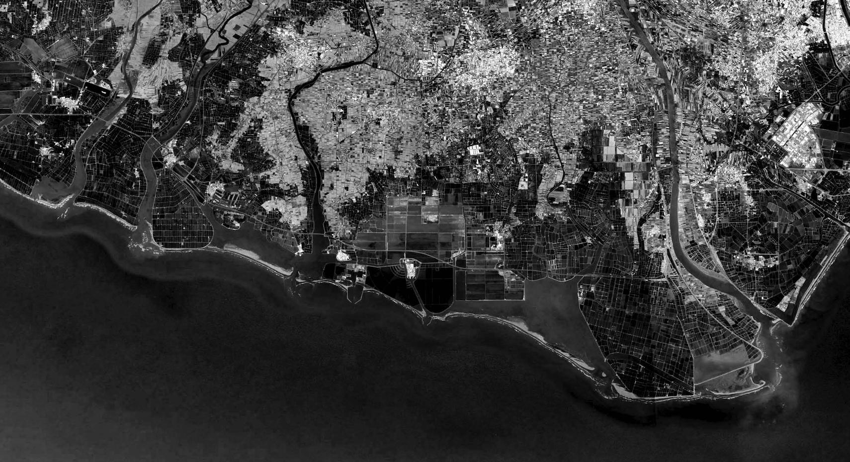
Being explored by limited NCKU scholars, planners, and agencies, the Tainan Beimen region urgently needs critical investigations in resilient approaches. The resilience for the area strongly depends on the holistic approaches on nature, ecological habitat, community living fragments, productive landscape, and water bodies that are multi-scalar and interdependent. Such integration calls for the use of the latest techniques and knowledge of biological and natural systems with help from other NCKU research teams. Besides, it also requires more sensitive and bottom-up approaches feasible for the local communities
The studio encourages foresighted integrated solutions of urban and architectural design keeping in mind that the area is a demonstration site for interventions in other parts of the region, as well as, promotes innovation in building technologies to ensure a community’s resilience particularly prior to climate disaster events. The speculative proposal should engage with urban and architectural design, technology, and policies that connect the physical and the social aspects of a community to promote its resiliency.
Three areas with different focuses are selected for broader exploration and discussion: Beimen, Jiangjun, and Qigu. Design projects should identify the issues and provide design strategies in the broader region, and propose the proper site(s) for interventions with multi-scalar design and programs mitigating the challenges from climate change.
The following aspects to be considered: Regional and local challenges; Resilient interdependent systems (environment, production, living…); Communal/ cultural/ religious/ industrial linkages; Participatory and social engagement; Urban and architecture typologies and prototypes; Multi-scalar approaches; Adaptation and Mitigation strategies; Replicable and Scalable Solutions.
High Temperature (Beimen); Coastal Erosion (Beimen); Sedimentation of Lagoon (Beimen); Seawall subsidence (Beimen); Flood (Beimen, Jiangjun); Torrential Rain (Qigu); Coastal Erosion (Qigu); Coastal Pollution (Qigu); Salt Injury (Qigu).
Beimen, Jiangjun, Qigu
Students:
Wei-Shun Wang
Ting-Ying Chen
Chieh Yu
Deng-Kai Shu
Yu-Fen Chiu
Yi-Chao Chen
Lin-Ju Chien
Ching-Wen Chiu
Yu-Shiang Sung
Due to the subtropical monsoon climate and the steep terrain in Taiwan. Lots of landslides are caused by typhoons with heavy rain and the coastline is eroded by waves. As a consequence, the sand-blocking dam was built upstream of the river in Taiwan in 1960. Unfortunately, landslides still happen when it is heavy rain and the sandbar has shrunk back because the sediment transport has decreased. The government started building the outer banquette near the coast of Tainan to decrease erosion caused by waves.
As a result, deviation of the sediment transport is disproportionate to artificial engineering, so there are big differences on the resilient coastline. The government wants to protect the western coastline in Taiwan which is made of oyster sheds and fish farms, so they built the artificial berm to prevent storm surge from happening. The coastline became more and more solid from a resilient situation with the development of artificial engineering. Therefore, the coastline lost the ability of resilience and the sandbar has shrunk back as time goes on, which leads to a threat to the industries near the coastline. The artificial engineering was unable to prevent typhoons which were bigger and bigger, so storm surge happened and overwhelmed the eastern settlement.
The strategy executed by the government was to build the embankments in different heights. If the embankment is broken, then it will lead to serious disasters. It only can prevent but can’t release the disasters, because the embankment is too high to drain water easily, in the other way, seawater also flows back to the land to lead to a flood in the settlement. The above situation caused serious disasters.

The strategy we designed is to modify “preventing the seawater in” to “release”, not to protect the industries and the settlements too much. Based on that the storm surge must happen, improve the serious disasters which were caused by the storm surge by “release the storm surge”、”spread risk of disaster” and “intensify the ability of recovery”.
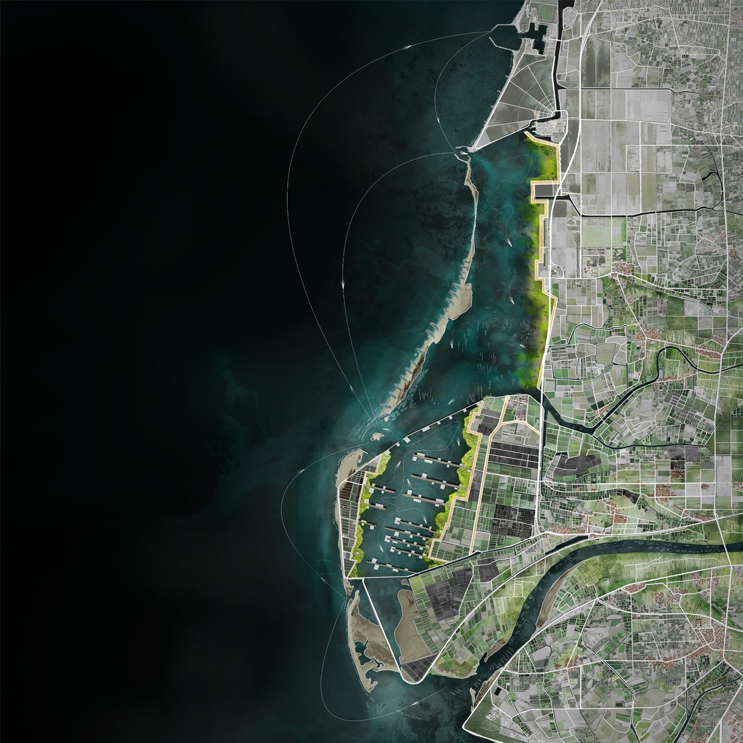
In the result, the key points of the design is how to redefine the balance among embankment, areas of industries and settlements. In the design, the site is cut for four parts, which are sand bars, lagoons, fish farms and settlements from the outside to inside. The design we do is hope to release the influence of the storm surge by different kinds of embankments set in different locations. If we want to reach the ability of resilience to balance the industries and the coastline, there are four requirements we should do: the energy of the waves releasing, time of detention extending, risks of industries spreading, the ability of resilience increasing.

The general direction of the design is the expansion of the lagoon to maintain the buffer zone/new-type outer fish farms/ oyster sheds to adapt to the backflow of seawater/ the inland fish farms advance pumping system to increase the flood detention time.
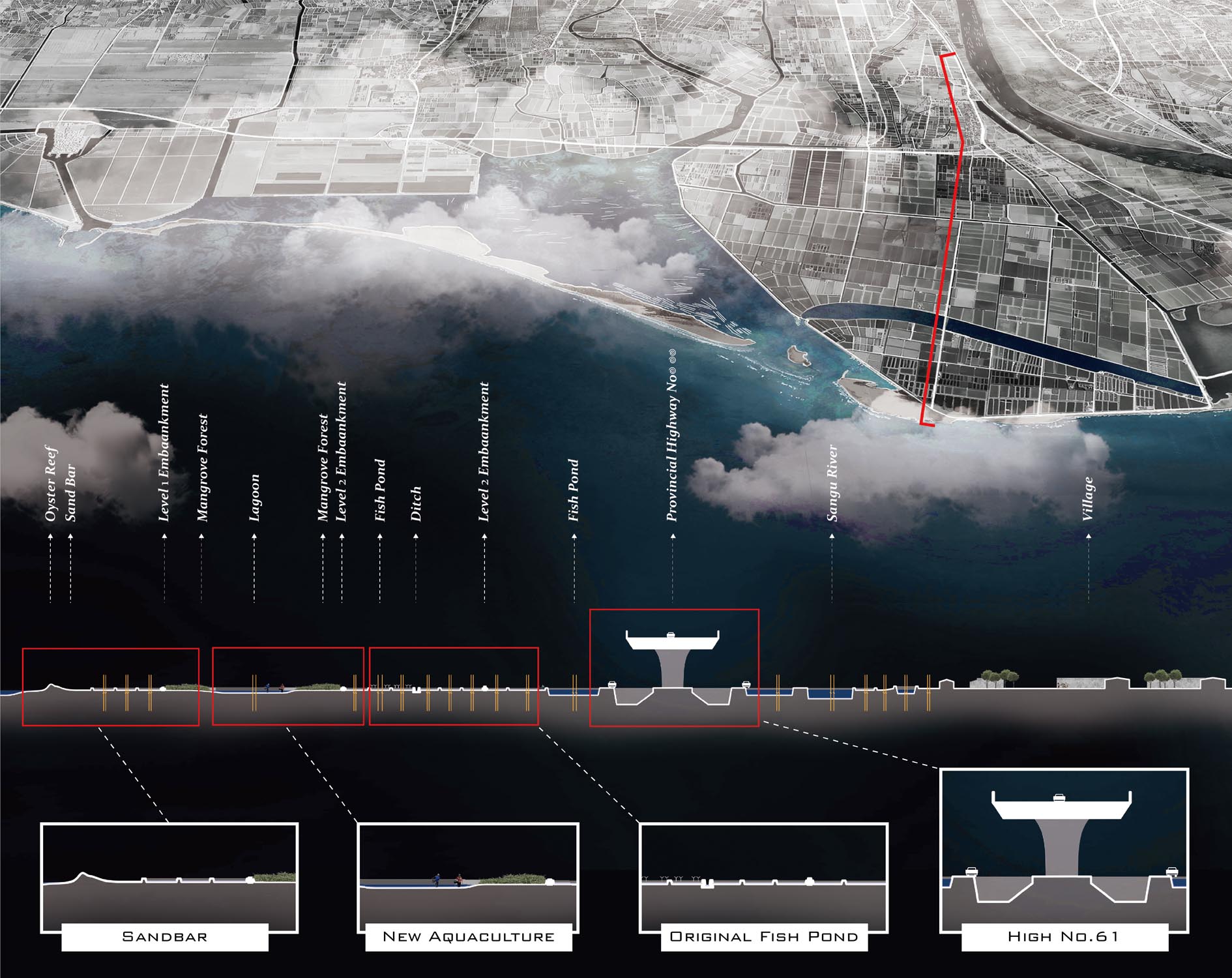
The sandbar will become the first line of defense against storm tide water levels. The design will focus on the mitigation of storm tides, and use the natural barrier of oyster reefs to solve the oyster shell waste generated by the oyster shell industry. The difficulty of natural oyster reef design is that the seedlings are not easy to attach.

It will be destroyed by waves when installed in the open sea directly. And it will be submerged by sandbar washing when installed in the internal lagoon. Therefore, the base of the offshore oyster reef will be designed to increase the attachment capacity, and the permeable bamboo piles will be added to protect it until the oysters attach and expand.
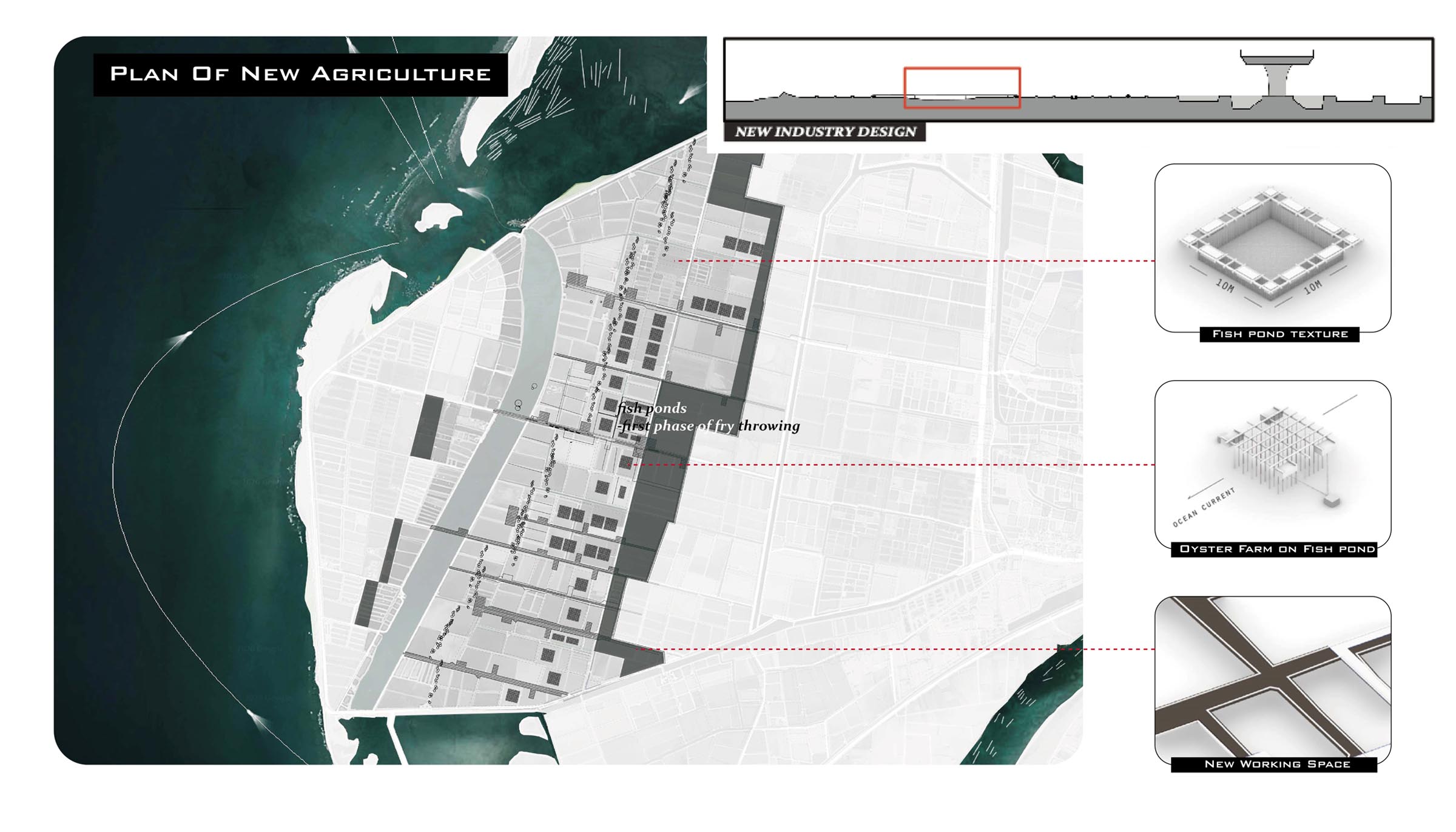
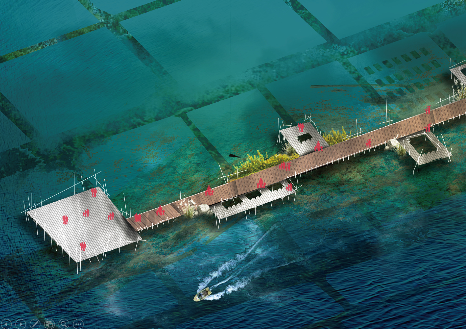
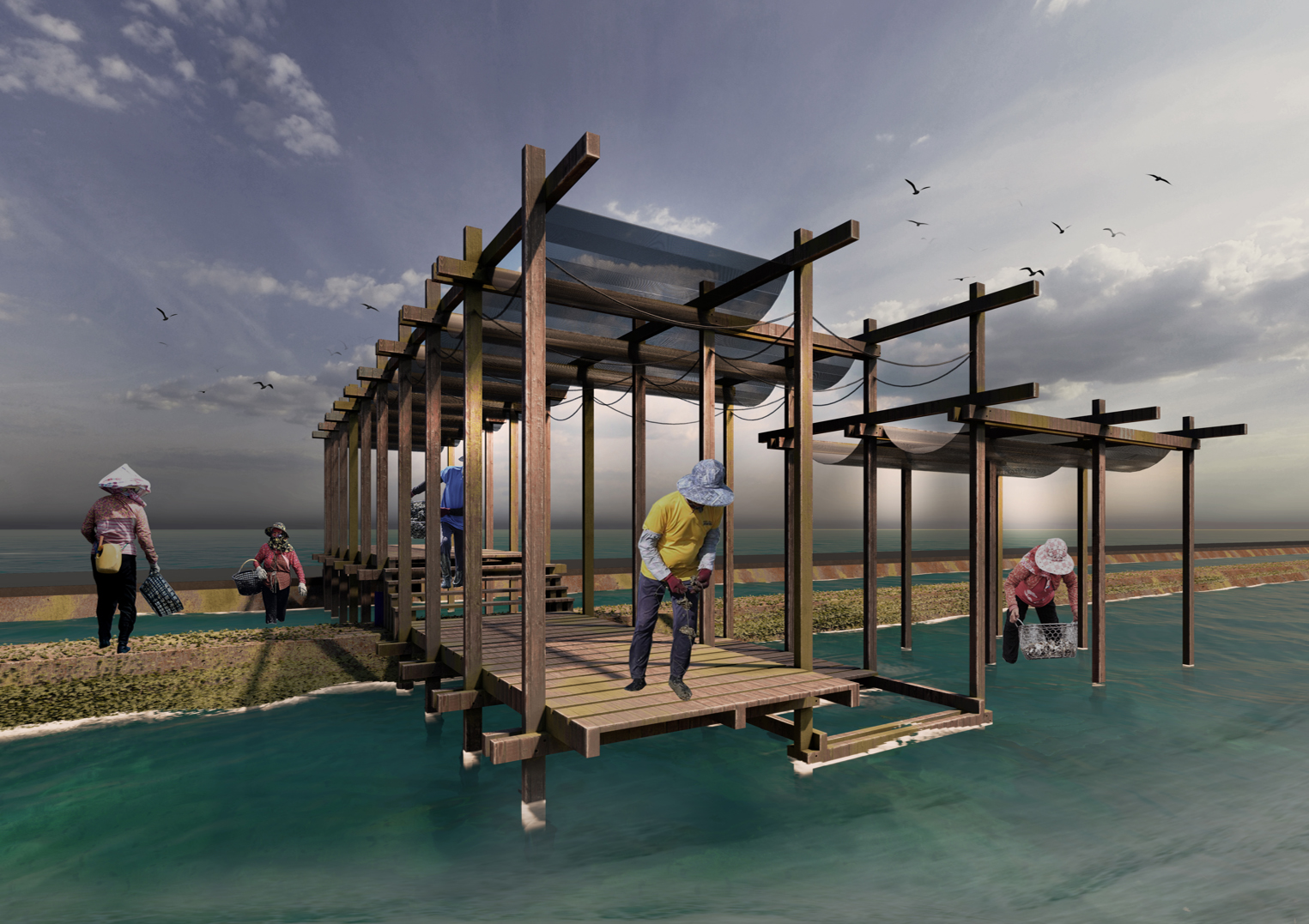
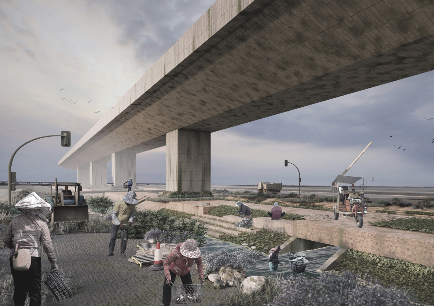
Through the demolition of the old dike, the Chigu Lagoon was restored to its state of being connected and flowing with the open sea before 1950. It also caused the two sides of the big tide gully to be gradually eroded and formed a new lagoon. While the original fish farms on the outside became a lagoon, they also retained the texture of the fish farms. And the dike line will recede according to the calculated flood detention.
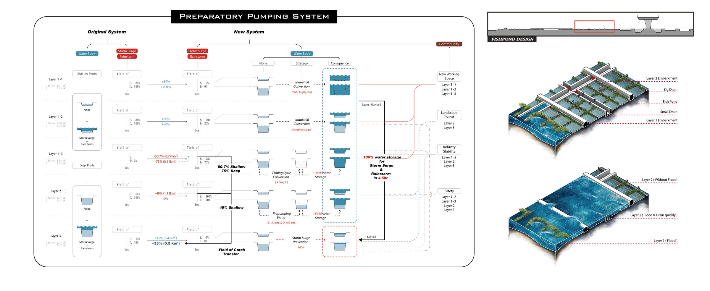
Beyond the new dike line, it will serve as the junction between the lagoon and the fish farm, which is usually not affected by the tide. However, it will be used as a buffer for a new type of industrial region that is flooded during a storm. And the dike becomes an area for industrial transportation and equipment operation.
